Plan it here. Load it on the plotter.
From the saloon table to the helmA cruise is not a departure and an arrival. It is a chain of hops, each with its own weather, its own tide, its own crew and its own moment where somebody has to decide whether to go. theONE plans it the way you actually run it — and then records what you really did.
Legs, not endpoints
Annapolis to Solomons is not one thing. It is Annapolis to Galesville, Galesville to Solomons — and on a longer cruise, four more after that. Each leg carries its own ETD and ETA, the tide state at the moment you expect to arrive, its costs, its notes, and its voice memos. You start one, you end one, and the next is already sitting there ready.
That structure is what lets the rest of the app be useful under way. A departure brief is per-leg because departure decisions are per-leg. Fuel and costs land against the hop that incurred them. And when something happens, it happened on a leg with a known position and a known crew aboard — which is the difference between an incident record and a story.
The marks in between
Type the name of a mark you actually round — Thomas Point Shoal Light, Knapps Narrows, Bloody Point — and theONE resolves it to a position and draws the leg on the chart with distance and time to run. Waypoints are how a real route differs from a straight line between two harbours, and a straight line between two harbours is not a route anybody steers.
Or let it plan the passage
You do not have to plot it by hand at all. Give theONE a start and a finish and it will lay out the route for you — including the long ones, the passage most marine apps quietly decline. It comes back as a proposal you review, not a route that just appears.
Then it goes to the plotter
Save the route as a GPX file — the universal chartplotter format — and load it on Garmin, Simrad, Lowrance, B&G, Raymarine or Furuno by card or companion app. No proprietary format, no subscription, and no re-typing waypoints at the helm with the engines running.
The footer on that button tells you how many positioned waypoints are actually riding the file, because a route file with one usable point is noise on every brand.
The rule about wrong waypoints
Place names on the water are not unique, and the most prominent match is frequently not the one a captain means. We measured this on a Chesapeake route: asked for a well-known island light, the map service returned a position sixty miles inland, in another state — in good faith, and with no indication anything was wrong. A twelve-mile hop was planned as eighty-six.
A route file goes into a real chartplotter and gets steered. We would rather hand you a waypoint short than a waypoint wrong.
So theONE checks a resolved position against the leg it belongs to. A mark that could not plausibly sit on that hop is left unplaced rather than written in as fact — judged against the leg's own scale, so a nine-mile harbour hop is held to a tighter standard than a fifty-mile open-water run. An unplaced waypoint is visible and fixable. A confidently wrong one is neither.
Following it, live
Start the leg and Mission Control gives you a follow surface on the same NOAA chart the planner drew: your boat as a live puck with a course chevron, the planned route beneath it, and a readout of speed over ground, distance to go and cross-track error. Not a general-purpose navigation display — a view of the leg you are actually on.
What a watch actually records
A leg is not just a line and a clock. Pick a preset and theONE puts watch items on the leg — engine hours, fuel, tank levels, position, weather — each one set to log every N minutes, or to nothing at all if you would rather log it by hand. Rename them per leg (“port engine hours” rather than “engine hours”) without breaking the entries already recorded, and save a set you like back to your own library.
Each item shows where its numbers are coming from — typed by hand, off the NMEA bus, or from the device itself — and it goes stale on the tile after two missed ticks rather than quietly showing you an old figure as a current one. Everything they record lands in the leg log, in order, with the rest of the passage.
She draws her own track
While the leg runs, theONE records where you really went.
- Sampled at the rate the moment deserves. A fix every five seconds under way; once a second through the first and last minute, because dock-out and dock-in are where the interesting boat-handling happens and a five-second sample turns a tight turn into a corner.
- Every fix carries more than a position. Time, latitude, longitude, speed over ground, course over ground, which GPS it came from, and, for a fix the phone took, the accuracy its GPS reported — so a stretch recorded with a poor fix is identifiable as such rather than silently trusted.
- Gaps are drawn as gaps. Pause the leg, or have theONE closed mid-leg, for a minute or more, and the track shows a break with no readout across it. A shorter pause is drawn as ordinary track. The alternative — a clean straight line joining two fixes an hour apart — is a drawing of a passage that never happened.
- Replay it. Scrub back through the leg with the readout following the cursor. Useful for a debrief, and considerably more useful when somebody asks where you were at 14:20.
- Or record with no plan at all. Track-only mode captures a cruise that was never a planned leg — the afternoon you just went. With no leg running it starts by itself once the boat has been above 2 knots for three minutes with theONE open, and saves itself after 30 minutes stopped; you can turn that off in Settings. It records the same way and hands off cleanly if it later becomes a leg.
- It is the boat's record. Tracks live in the same on-device store as the rest of your data — roughly 400 KB for a long leg. If you are signed in, a finished track is sent once, when its recording ends, and travels with the boat's record like the rest of it (privacy policy, section 3a); your position is not streamed while you record. It is not sold, and not mined for anything.
The rest of under way
- Live Activity — active leg, ETA and telemetry in the Dynamic Island, readable mid-passage without unlocking anything — unless theONE's app lock is on.
- Apple Watch — heading, speed over ground, depth, tanks and MOB on the wrist, all through the iPhone aboard.
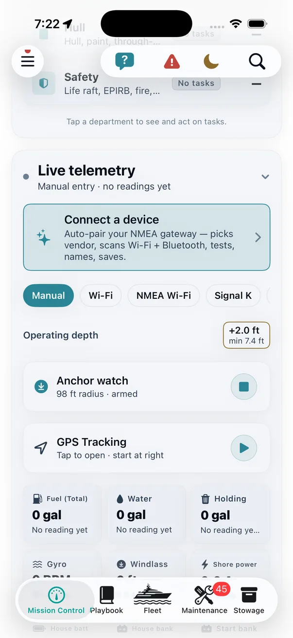
- Anchor Watch — armed at the GPS fix, at a radius you set. If the boat moves outside it you get the drag alert, not the morning surprise.
- Float Plan — departure, destination, souls aboard, expected return, filed in under a minute and sent to a dockmaster or a shore contact — with an overdue monitor watching the clock behind it.
- Emergency Drawer — one tap for a GPS-timestamped MOB pin, USCG contacts and DSC radio procedure. Built for cold hands and no time, and it works with zero signal.
In the Help Center
Honest about the edges
The file is always available; the wire is not always there. A route leaves as a GPX file by card or companion app on every plotter there is, and that path never depends on a network. Where theONE can also reach the plotter directly — onto the NMEA 2000 bus through a YDWG or Actisense gateway, or as NMEA 0183 route sentences through an 0183 gateway — a Send route row appears beside it; a Signal K server or a Vesper Cortex feeds theONE data but does not take a route. It appears only when a gateway is set up for the boat, and if that gateway is not answering when you send, it says so by name rather than pretending the route went.
The track is the phone's GPS, or the boat's when a gateway is feeding it a position. It is as good as the fix it was given — which is why every point says which GPS it came from, and the phone's reported accuracy is stored with every point it took instead of being thrown away.
Charts, tides and weather are NOAA-backed and cover US coastal waters. International coverage is not in this build.
A resolved mark is a map service's answer, not a survey. theONE rejects the implausible ones and shows you the rest on a chart so you can see what you are about to steer. It is a planning aid. It is not a substitute for your own charts, your own eyes, or proper passage planning.
Safety features supplement — they never replace — proper seamanship and USCG requirements.
Why it works this way
Because the moment that matters is not planning the trip. It is standing at the helm at 0700 deciding whether today is the day — and everything above exists so that decision is made with the tide, the weather, the crew, the boat's open items and the route all in one place, rather than across four apps and a piece of paper. And when you are back on the dock, what you did is already written down.